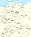
לקובץ המקורי(קובץ SVG, הגודל המקורי: 2,220 × 1,554 פיקסלים, גודל הקובץ: 573 ק"ב)

זהו קובץ שמקורו במיזם ויקישיתוף וניתן להשתמש בו גם במיזמים אחרים.
פרטי הקובץ שמופיעים למטה נלקחו מדף תיאור הקובץ המקורי.

תקציר

תיאור Test version of a vectorized File:Rzeczpospolita 1920.png; more changes will follow, only checking if wiki displays it right
תאריך יצירה
מקור

נוצר על־ידי מעלה היצירה; based on an earlier raster map made in 2005, as well as similar maps made by myself in 2004 (see below).
In preparation of this map I used many other maps as sources and backup. Among them were:

  • a German roadmap of Poland printed in 1938 (colours and the shape of East Prussian border)
  • and perhaps a dozen others.
יוצר Halibutt
גרסאות אחרות
SVGהתפתחות 
InfoField
 
קוד המקור של קובץ SVG זה הוא לא תקין בגלל 2 שגיאות.
 
, Adobe Illustrator עם‎‎ נוצרה ה W3C-לא תקין גרפיקה וקטורית
 
ו עם Inkscape.
 
 This map uses embedded text that can be easily translated using a text editor.


Copyright notice: Image made by Halibutt and uploaded to Wikipedia by the author. Images can be made available for use under other copyleft licenses on a case by case basis via direct contact with the author. Under moral rights the user requires that this work be properly attributed to its creator. For photographs, this is traditionally done in the image caption. Where a copyright notice is present, using the copyright notice in the caption will be sufficient. Note that the GFDL requires that any copyright notices be included with the work even when making unmodified use of it.

Since the legal status of the above comment has been questioned, I hereby grant anyone the right to treat it as either a standard copyright notice, invariant section, legal statement, legal advice, friendly suggestion or a mere comment, depending on his or hers own choice.
Halibutt
GNU head מוענקת בכך הרשות להעתיק, להפיץ או לשנות את המסמך הזה, לפי תנאי הרישיון לשימוש חופשי במסמכים של גנו, גרסה 1.2 או כל גרסה מאוחרת יותר שתפורסם על־ידי המוסד לתוכנה חופשית; ללא פרקים קבועים, ללא טקסט עטיפה קדמית וללא טקסט עטיפה אחורית. עותק של הרישיון כלול בפרק שכותרתו הרישיון לשימוש חופשי במסמכים של גנו.
w:he:Creative Commons
ייחוס שיתוף זהה
הקובץ הזה מתפרסם לפי תנאי רישיון קריאייטיב קומונז ייחוס-שיתוף זהה 3.0 לא מותאם.
הנכם רשאים:
  • לשתף – להעתיק, להפיץ ולהעביר את העבודה
  • לערבב בין עבודות – להתאים את העבודה
תחת התנאים הבאים:
  • ייחוס – יש לתת ייחוס הולם, לתת קישור לרישיון, ולציין אם נעשו שינויים. אפשר לעשות את זה בכל צורה סבירה, אבל לא בשום צורה שמשתמע ממנה שמעניק הרישיון תומך בך או בשימוש שלך.
  • שיתוף זהה – אם תיצרו רמיקס, תשנו, או תבנו על החומר, חובה עליכם להפיץ את התרומות שלך לפי תנאי רישיון זהה או תואם למקור.
תבנית רישוי זו הוספה לקובץ כחלק מעדכון רישיון GFDL.

The following is a list of maps created by Halibutt and uploaded to commons, as well as their present and projected derivatives.

Parent Image Image Description
  Maps by Halibutt
Image:Rzeczpospolita.png Image:Rzeczpospolita.png The Republic in 17th and 18th century
Image:Rzeczpospolita 1600.png The Republic after the Treaty of Dywilino
Image:Rzeczpospolita voivodships.png Voivodships of The Republic
Image:Rzeczpospolita_Potop.png The Republic during The Deluge and Chmielnicki Uprising, with major battles of the era marked
Magnates and their lands and domains
1st2nd3rd Partitions of Poland
War of the constitution
Image:Rzeczpospolita.xcf SOURCE FILE - GIMP format
Image:Poland 1939.png Image:Poland 1939.png Poland in 1939
Image:Dywizje wrzesien 1.png Order of Battle on September 1st, during the Polish Defence War of 1939
Image:Poland 1939.xcf SOURCE FILE - GIMP format
Image:Polska kontur bialy.png Image:Polska kontur bialy.png Contour map of Poland AD 1999, for use with various locator maps
Image:Rzeczpospolita 1923.png Image:Rzeczpospolita 1923.png Map of Poland 1918-1939, currently under development
Image:PBW March 1919.png Polish-Bolshevik War - fronts in March of 1919
Image:PBW December 1919.png Polish-Bolshevik War - fronts in December of 1919
Image:PBW June 1920.png Polish-Bolshevik War - fronts in July of 1920
Image:PBW August 1920.png Polish-Bolshevik War - fronts in August of 1920
Polish Defence War of 1939
Polish areas annexed by Germany, Lithuania, Slovakia and the Soviet Union
German concentration camps in Poland
Curzon line
Major battles of the Polish-Bolshevik War
namesno names Polish/Czechoslovak/Lithuanian/German/Ukrainian claims in 1920's
Image:Rzeczpospolita Central Lithuania.png Central Lithuania
Image:Rzeczpospolita Lithuania claims.png Central Lithuania as compared with other Lithuanian claims
Image:Rzeczpospolita 1789-1920.png Post-1922 borders compared with the territory of Poland before the partitions
Warsaw Uprising and the Operation Tempest
Poland partitioned between the Soviets and the Germans
Image:Rzeczpospolita 1939 Polish divisions.png Polish divisions on September 1, 1939
Home Army inspectorates
Image:Rzeczpospolita 1922.xcf SOURCE FILE - GIMP format
Image:Rzeczpospolita 1937.svg Vector version!!!! layered version available on request

כיתובים

נא להוסיף משפט שמסביר מה הקובץ מייצג

פריטים שמוצגים בקובץ הזה

מוצג

היסטוריית הקובץ

ניתן ללחוץ על תאריך/שעה כדי לראות את הקובץ כפי שנראה באותו זמן.

(החדשות ביותר | הישנות ביותר) צפייה ב: (10 הבאות | ) (10 | 20 | 50 | 100 | 250 | 500)
תאריך/שעהתמונה ממוזערתממדיםמשתמשהערה
נוכחית18:24, 1 בינואר 2017תמונה ממוזערת לגרסה מ־18:24, 1 בינואר 2017‪1,554 × 2,220‬ (573 ק"ב)Sascha GPDMalmö (duplicate) -> Göteborg
17:34, 30 ביולי 2013תמונה ממוזערת לגרסה מ־17:34, 30 ביולי 2013‪1,554 × 2,220‬ (573 ק"ב)HalibuttAdded some rivers in Russia, corrected others (RO, HU, PL)
06:28, 30 ביולי 2013תמונה ממוזערת לגרסה מ־06:28, 30 ביולי 2013‪1,563 × 2,220‬ (458 ק"ב)HalibuttSweden corrected (town names added)
06:16, 30 ביולי 2013תמונה ממוזערת לגרסה מ־06:16, 30 ביולי 2013‪1,567 × 2,214‬ (492 ק"ב)Halibuttcrunched version (deleted background layers)
06:13, 30 ביולי 2013תמונה ממוזערת לגרסה מ־06:13, 30 ביולי 2013‪1,567 × 2,214‬ (3.68 מ"ב)Halibuttlet's see if the expanded version works
21:11, 16 ביולי 2010תמונה ממוזערת לגרסה מ־21:11, 16 ביולי 2010‪1,567 × 2,014‬ (534 ק"ב)HierakaresCorrected position of name Oppeln which was overlapping with point.
11:54, 14 במרץ 2008תמונה ממוזערת לגרסה מ־11:54, 14 במרץ 2008‪1,567 × 2,014‬ (534 ק"ב)HalibuttNames of larger towns enlarged
11:45, 14 במרץ 2008תמונה ממוזערת לגרסה מ־11:45, 14 במרץ 2008‪1,567 × 2,014‬ (533 ק"ב)Halibuttversion corrected by Madman
03:30, 14 במרץ 2008תמונה ממוזערת לגרסה מ־03:30, 14 במרץ 2008‪1,534 × 2,000‬ (512 ק"ב)Halibutt{{Information |Description= |Source=self-made |Date= |Author= Halibutt |Permission= |other_versions= }}
02:54, 14 במרץ 2008תמונה ממוזערת לגרסה מ־02:54, 14 במרץ 2008‪1,534 × 2,000‬ (548 ק"ב)Halibutt{{Information |Description= |Source=self-made |Date= |Author= Halibutt |Permission= |other_versions= }}
(החדשות ביותר | הישנות ביותר) צפייה ב: (10 הבאות | ) (10 | 20 | 50 | 100 | 250 | 500)

שימוש גלובלי בקובץ

אתרי הוויקי השונים הבאים משתמשים בקובץ זה:

צפייה בשימושים גלובליים נוספים של קובץ זה.

מטא־נתונים